Tuesday, 18 September 2007
Spring
Sunday, 20 May 2007
Monday, 30 April 2007
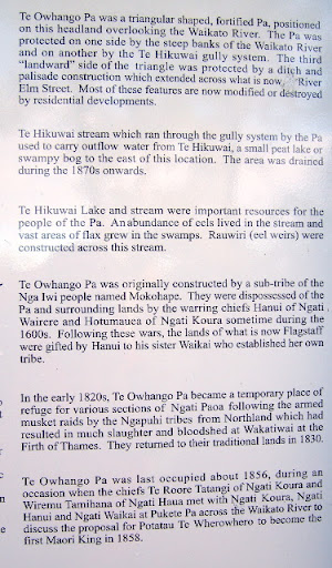
Owhango Pa
 ...continuing from the Owhango River Planting trial entry ...
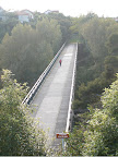
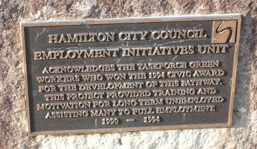
If you continue up the walkway from where the RAFT plantings are the path eventually swings away from the river up the Te Hikuwai stream. Coming from this direction it is easy to miss the sign on your left that marks the track up the hill to the Owhango Pa site. The sign demonstrates a brilliant collaboration between the Hamilton City Council and Nga Mana Toopu o Kirikiriroa. Bilingual in its presentation, it tells of the Maori and geographic history of the area. Indeed, it leads me to believe that Flagstaff, with all its colonial implications, might have been better named "Owhango" or "Te Hikuwai". I have reproduced the english version of the sign here. Annoyingly, someone had thrown mad at the sign and the others parts were not photographable.
Beyond the sign is a short climb up to the actual pa site. I suspect that many would want to covert this piece of real estate. The site is perfectly flat and the views brilliant. It is also very easy to see why it was selected as a sanctuary and point that could be defended. This is a must see if you are ever in the area.
image slide show
Owhango - Riverside Planting Trial
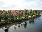
Once over the Pukete to Flagstaff footbridge you can either continue up the hill to River Rd, or drop back down to the river and pick up the walkway in front of the Allandale rest home. On the river bank directly in front of the rest home is a really good example of what the River Action Focus Team have been up to. There are a number of riverside planting trials along the river and these Harakeke look like the last five years have treated them really well. The RAFT website tells me that there are also plantings at the following sites:
- The Alandale site was planted in 12 May 2002
- Claudelands Bridge site planted 5 May 2002
- Malcolm Street was replanted in October 2003
- Ann Street (St Andrews) November 2000
- Sycamore Place (Pukete) November 2000
Pukete
 Yesterday took me to a series of interesting sites around the Pukete, Hikuwai, and Owhango areas of the
 I started out down
 I do hope that the city council has plans to extend the walkway further as I think that there is some real potential to link from Pukete to Horotiu either on the Pukete side or
Saturday, 28 April 2007
Wairere
 Today we took a walk around the Wairere Bridge area of the Waikato/Hamilton walkway. We went from Delamere Rd, over the Wairere Bridge, up into Harrowfield and across the Harrowfield footbridge into Flagstaff. The Harrowfield footbridge really disguises a major service utility that connects to the Hamilton water treatment plant a few kilometers away. We circled around the Flagstaff shopping centre back down on to Wairere bridge and back home. The walkways on this route took us safely and conveniently under River Rd but one always needs to be wary of speeding cyclists. In the past, some unfortunate walkers have been knocked over, some with fatal results. I see now that they have installed mirrors so that walkers and cyclists alike can see what's coming around the corner.
Having lived in the area for the last 10 years or so, I well remember the building and opening of the Wairere Drive Bridge. The day was a blaze with colour, fun, activity and people who partied into the night at a council sponsored event at Braithwaite Park.
 Kia ora! Te Awe a.k.a. Ngahuia here, feeling good after our local hikoihaere. We crossed The Wairere Bridge which was opened by The Lady, Te Arikinui Te Atairangikaahu in midwinter 1996, with a massive dawn whakaminenga from Turangawaewae (TPM) and Hukanui. Fabulous views.
Monday, 23 April 2007
Hakanoa
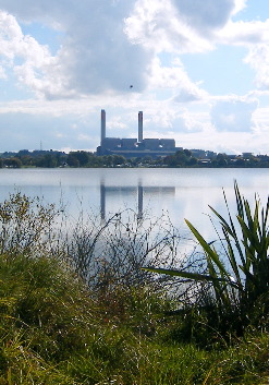 We may have seen the Huntly Power station and it's dominating chimney stacks, but do many of us know about Lake Hakanoa? I think that Lake Hakanoa is one of Huntly's best kept secrets, as I found out this Sunday when Elizabeth, Tomairangi and I went to check out the route for the Huntly half marathon 21km. The half marathon takes in the Hakanoa lake twice! You can learn all about the history and development of the Hakanoa walkway at http://www.huntly.co.nz/recreation.htm. The lack track is well benched, all flat and pretty much wheel chair friendly all the way around. And there are some really great points of interest, like the Green Cathedral and the 'country' gardens. The widelife is also very entertaining and curious especially if you're not familiar with Canadian geese or Pied Shags. I especially appreciated the various information boards around the track that provided a great run down of fish species and birds. More i
 mportantly, at the Hakanoa gateway a notice board provides a brief overview of the Maori and colonial history of Huntly and of how Lake Hakanoa comes to have it's name. An extract from the notice board reads...
- "Haka Noa - Lake Hakanoa derives its name from the ritualistic war chant that was performed by ancient Maori warriors belonging to local hapu (tribe), Ngati mahuta and Ngati Whawhakia. Rejoicing of the people - the time for fishing was near. It was time for the ceremony of the Noa, (lifting of the tapu) so people could fish the waters again. The naming of the lakes were done by the Chief Potatau Te Wherowhero, Te Paki and Heta Tarawhiti."
How to get to Lake Hakanoa from Hamilton: Take SH 1 to Huntly. When you arrive at Huntly, turn right into Rayner Rd, then left into William St, and then right at Onslow Street. You will find yourself in the Domain, the walkway following the shoreline.